North Oaks, Minnesota is the only city in the United States that is not on Google Maps Street View. YouTube documentarian Chris Parr, who grew up not too far from North Oaks, set out to change that earlier this year. For a brief few days, he literally put North Oaks on the map. And then it was gone again.
“It’s known by Minnesotans as a place where executives and CEOs live,” Parr told 404 Media. “Famously Walter Mondale is from North Oaks, but also like United Healthcare executives and Target executives.”
North Oaks has managed to largely stay unmapped on Street View because of the way the city handles its streets. In almost every city and town in the United States, property owners give an easement to their local government for the roads in front of their homes (or don’t have any claim to the roads at all). In North Oaks, homeowners’ property extends into the middle of the street, meaning there is literally no “public” property in the city, and the roads are maintained by the North Oaks Homeowners’ Association (NOHOA): “the City owns no roads, land, or buildings. The 50-60 miles of roads in the city are owned by the NOHOA members whose property extends to the center of the road subject to easements in favor of NOHOA,” the homeowners association’s website, which has very little information on it and notes that it is “unable to share most private documents with the public.” The roads entering North Oaks have no trespassing signs posted and automated license plate readers.
In the early days of Google Maps, North Oaks was on Street View. But in May, 2008, the city threatened Google with a lawsuit because its Street View cars had trespassed. Google deleted its Street View images and North Oaks hasn’t been on Street View since.
“It’s not the hoity-toity folks trying to figure out how to keep the world away,” then-Mayor Thomas Watson told the Star Tribune in 2008. “They [Google] really didn’t have any authorization to go on private property.”
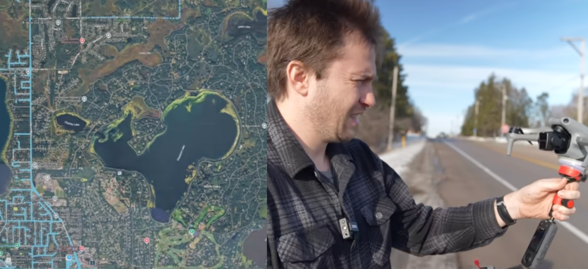
Google Maps allows people to upload their own images, however. And Parr set out to find a way to map North Oaks without actually going there. So he began mapping it with a drone.
“It’s a geographic oddity,” Parr said. “I realized the airspace above North Oaks operates differently than the property on the ground. I thought you could effectively map the city with a drone.”
Parr is right. The national airspace is technically managed by the Federal Aviation Administration, and “airspace” starts directly above the ground, which is something I covered over and over in the early days of consumer drones as towns sought to ban drones in certain areas.
“Technically, if you launch your drone from public property, which anyone can do if you’re a registered drone pilot, you can fly it straight up and above private property,” Parr said. And so Parr stood at “six or seven different spots” directly outside the boundary of North Oaks and flew his drone around. “I just pulled my car over onto the shoulder and popped my drone up and flew it over,” he added.
There were parts of North Oaks that he couldn’t reach by drone from outside the boundaries of the city, so eventually he decided he needed an invite into the city to go to a park within its boundaries to keep flying his drone.
“According to North Oak’s ordinances, you can go like, visit a friend, or if you’re a contractor working on a house, you can go into the city, but you have to be an invited guest,” Parr said. “I made a Craigslist post asking for somebody to invite me and I got an absolute ton of responses. I started texting with this woman named Maggie and she invited me, so technically I had the invite to go to the park.”
Parr then took his drone footage and uploaded it to Google Maps. For a few glorious days, North Oaks was mapped. And then it was gone.
“I’ve since been in a battle with the people who flag the images,” he said. He also got a letter from a law firm representing the North Oaks Homeowners Association. “It’s not asking me to take any of the videos down or anything, but basically they say, ‘Don’t come back.’”
Parr’s experiment and documentary raises questions, of course, about who gets to have privacy in America. A wealthy enclave has set up the legal and surveillance infrastructure to be able to prevent being mapped. The rest of us, meanwhile, are subject to all sorts of surveillance by our neighbors and law enforcement. “The only reason it’s set up this way is because it’s such a wealthy community,” Parr said. “I know that I was able to do this, but I don’t know if I should be able to do this, and that’s kind of the question that I wanted to tackle. The YouTube comments are pretty crazy man. They’re all over the place. They’re very split 50/50 on that question.”
North Oaks did not respond to a request for comment.